

2019-2023
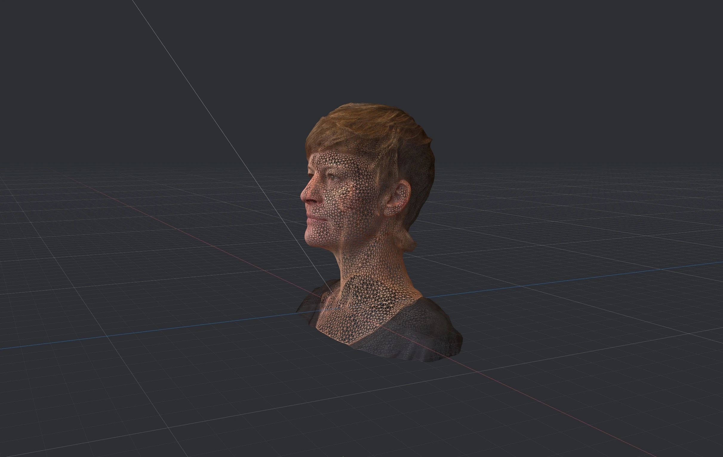
Nomoko's mission was to bridge the physical and digital worlds. We created the first 3D digital twin platform for real estate, using high-resolution data from drones, enriched with legal and market information. Recognising its broader potential, we expanded to offer 3D streaming solutions for various industries to build geospatial applications.
Initially, I developed a brand architecture and design system, was then invited to join the management team as Head of Design, enhancing design’s strategic role. I built and managed a team (up to six people plus agencies at peak times) covering 3D, graphics, photo, video, and digital product design, including UX/UI and map design. Over four years, I fostered a talented, happy team, earning very positive feedback on everything design, both in-house and from external users, whilst on tight budgets and deadlines.
Later, as Head of Studio, I was responsible for establishing an independent in-house consultancy, helping clients from various industries create digital twin solutions, handling strategy, processes, client management and delivery.
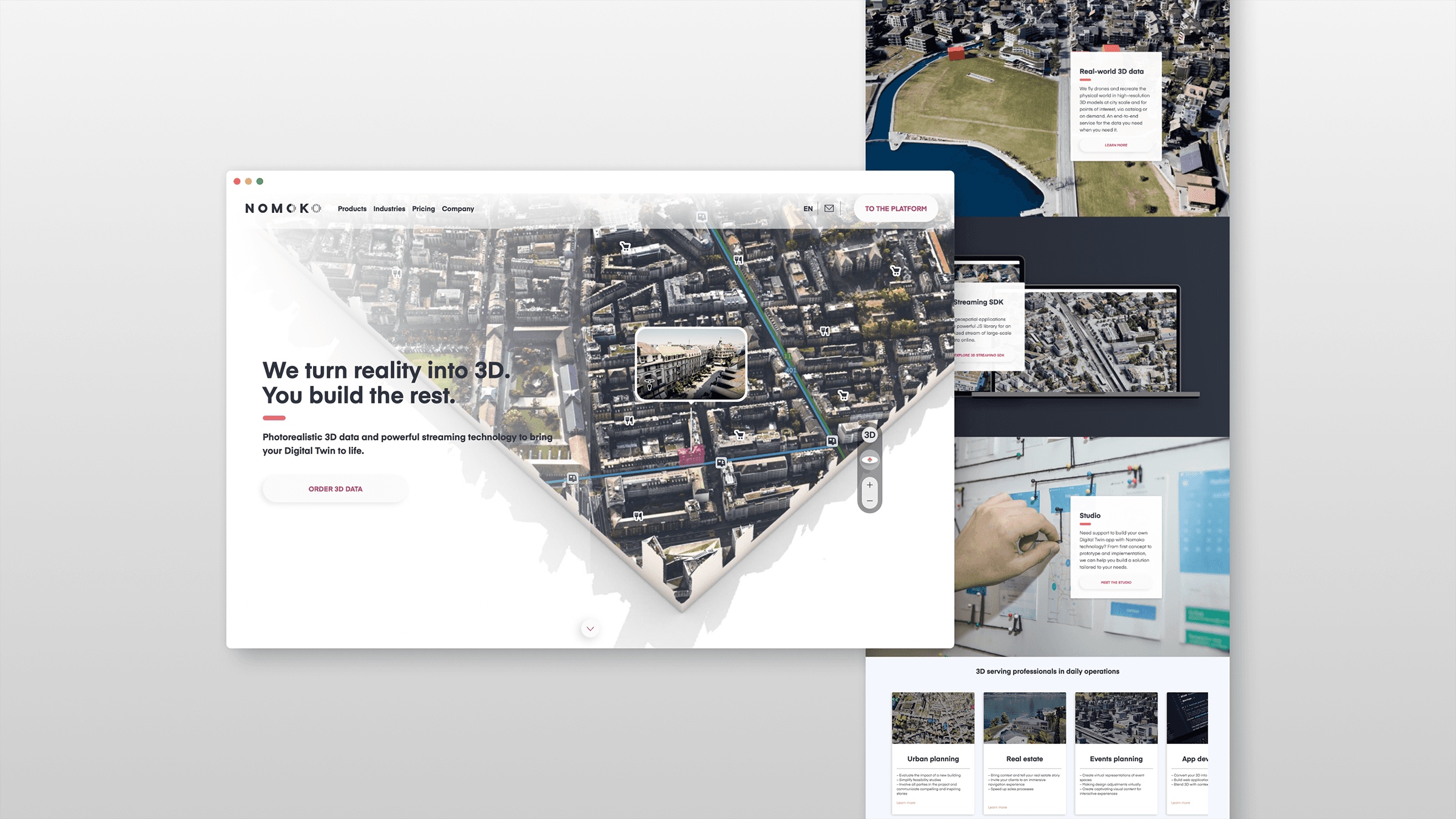
I was involved from category design workshops to brand architecture, naming and creating a scalable visual design system, from hands-on creation to management of the in-house design team and external agencies.
From initial value proposition workshops to cross-team processes, prototypes, UX, UI, map designs, design systems, testing and delivery, I was responsible for managing every aspect of the product design.
Interactive data calculator and data visualisation
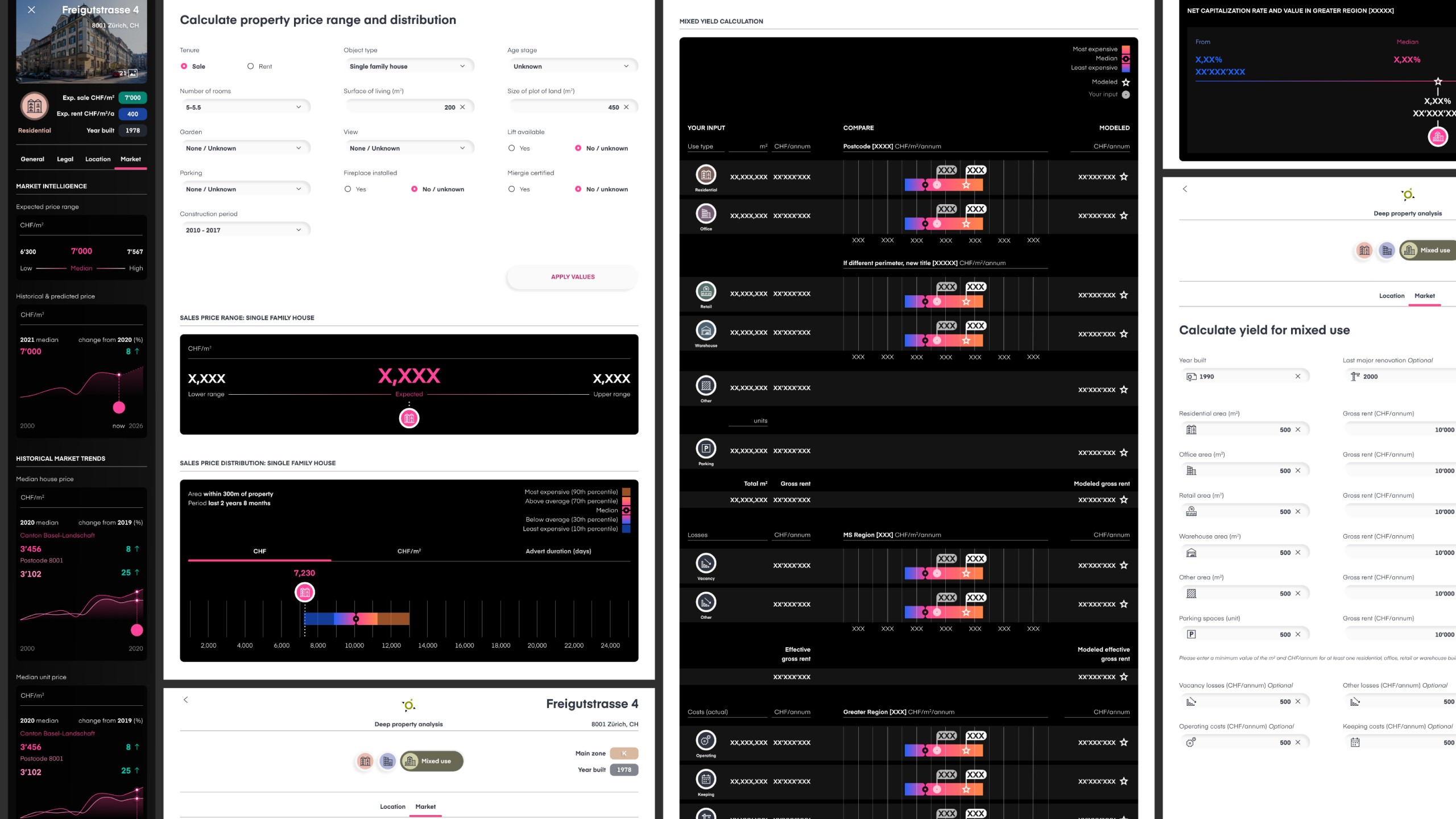
An example of how we integrated complex partner data and radically simplified lengthy processes in real estate investment into our application.
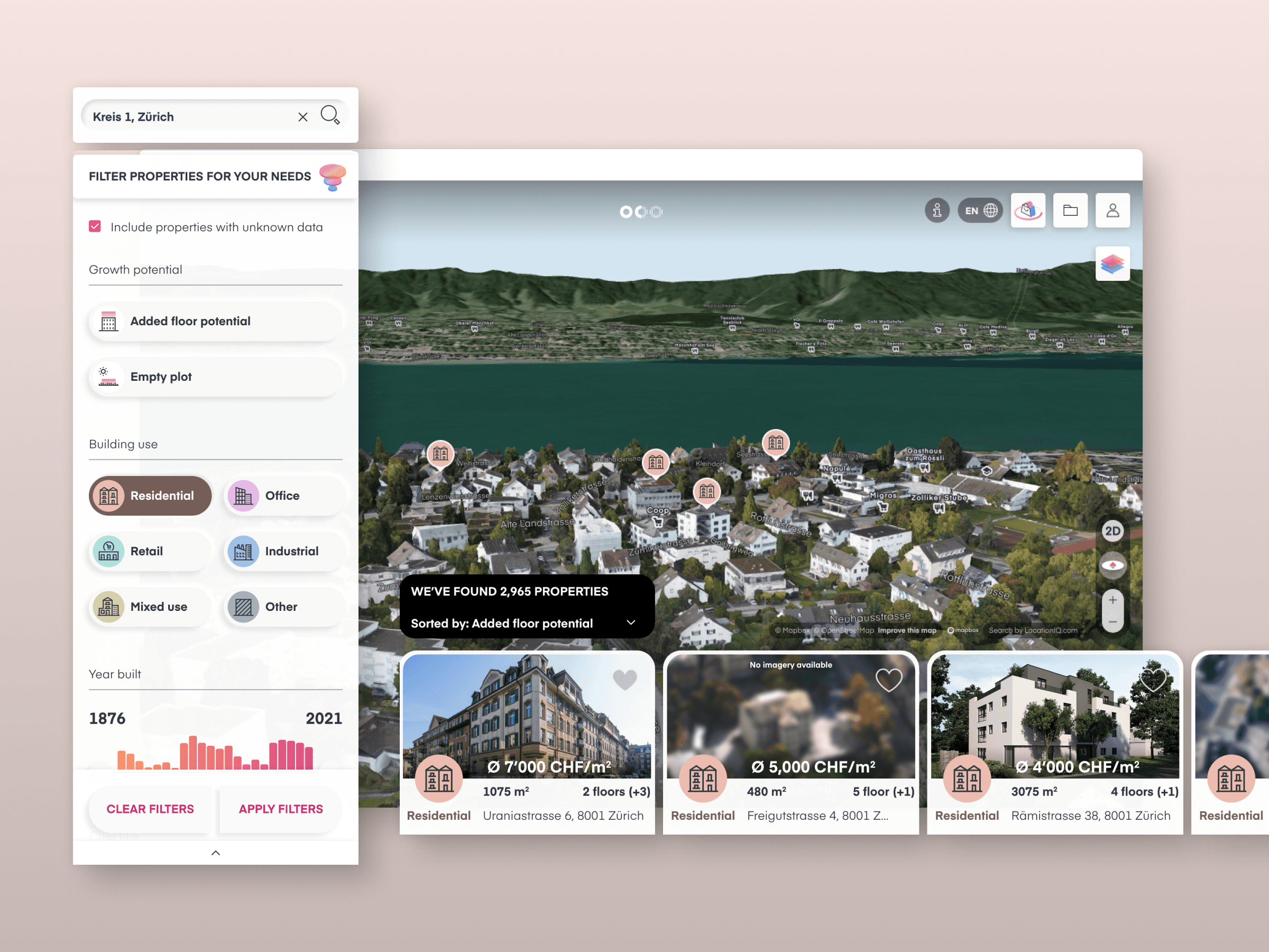
Map design and data layers
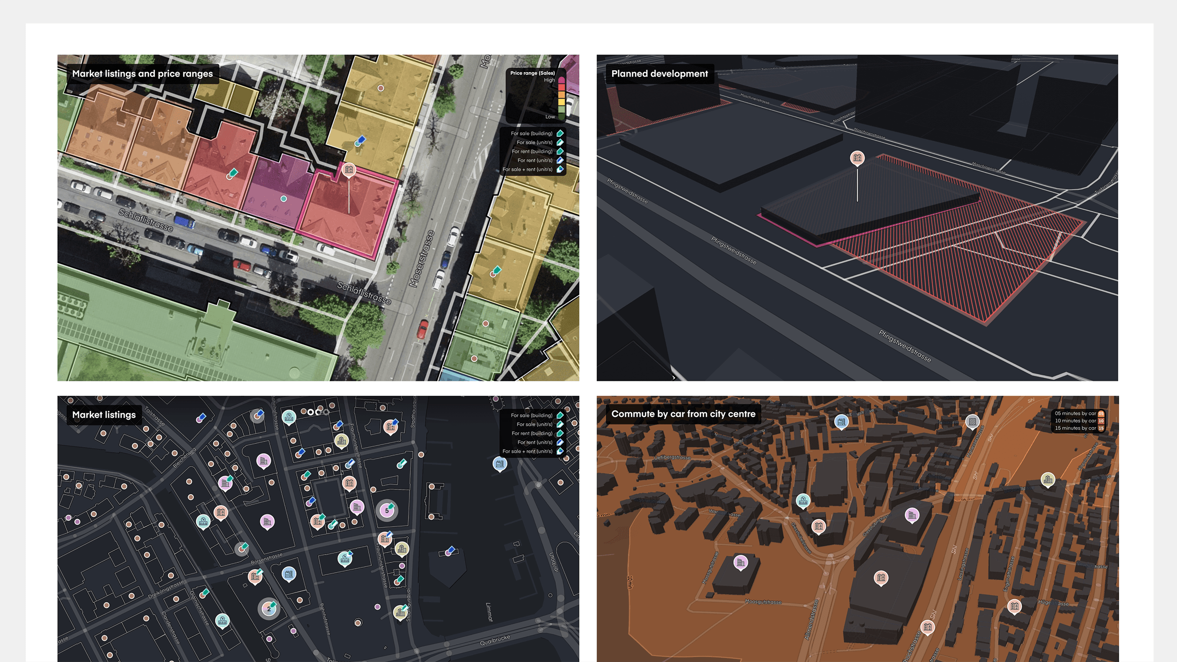
Interactive maps are an integral multi-dimensional canvas for using, understanding and leveraging geospatial data. We used Mapbox to style and define everything: from 2D to 3D, abstract to realistic, place marks to paths, and hyper-local experiences to global zoom levels.
Browse all portfolio projects


© Anki Delfmann 2024